Indigenous tribe maps out ancestral land in the Philippines
International Alert has begun working with an indigenous tribe in the southern Philippines that wants to map out its ancestral land to identify which areas can be opened to investments and which should be preserved or rehabilitated.
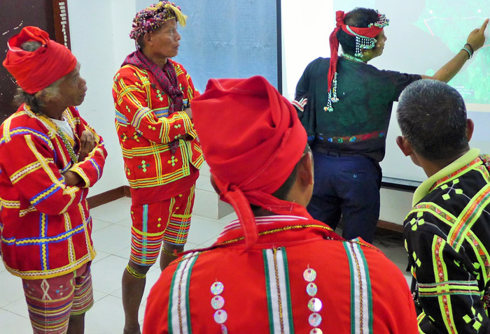
Leaders of the Ata-Manobo tribe in Talaingod and local government officials of this poor but resource-rich town in the province of Davao del Norte attended a week-long workshop in November on the resource use and management plan (RUMP) that we developed.
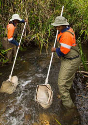
The RUMP process brings members of a community together so that, collectively, they define and decide how land is and should be used. By identifying and resolving competing land claims, the process promotes sustainable resource use and development and mitigates conflicts.
Talaingod has a population of around 27,500 and is comprised of the rural villages of Dagohoy, Palma Gil and Santo Niño. It is mostly populated by members of the Ata-Manobo tribe, who largely depend on a virgin forest that covers about a tenth of the town for their livelihoods. Located in the mountains of Davao del Norte, Talaingod has been caught in the violent conflict between government troops and communist rebels.
The RUMP for Talaingod will map out the town’s remaining resources and provide the platform for dialogue between those sympathetic to the communist rebels and those who resent their presence. It was initiated by the National Commission on Indigenous Peoples (NCIP), the government agency tasked with protecting the welfare of indigenous peoples in the Philippines.
The NCIP is a partner in our ‘conflict-sensitive economic governance’ (CSEG) programme in the Philippines. CSEG aims to form partnerships between indigenous peoples, local governments and businesses to ensure that indigenous peoples take part in the decisions that affect their lands and livelihoods.
The CSEG programme has developed RUMPs in five provinces across the Philippines. It also established the Mindanao IP Desk – our joint initiative with NCIP and the Mindanao Business Council that facilitates dialogues between indigenous tribes, companies that want to put investments within their ancestral lands, and the concerned local government units. The Desk matches tribes’ development plans (such as the RUMP) and companies’ business plans, improving understanding across different groups.
During the workshop, Talaingod local government officials and tribe leaders divided themselves into three groups to delineate the land uses in the different villages. They also answered guide questions designed to make the RUMP conflict and gender sensitive. Once land uses were identified, this data was plotted to create digital maps for each village which visually represented the outcomes of the RUMP process.
All the information gathered will now be presented to the Ata-Manobo for validation. A report compiling this data will also be created which will help inform decision-making and negotiations by the Ata-Manobo, and policy-crafting by local government officials.
The report will also provide crucial data for civil society and non-government organisations working in advocacy and research in the fields of indigenous rights, resource management, conflict sensitivity and conflict resolution.
Find out more about our work on natural resource management.